
Dr Sarah Parcak’s discoveries will be revealed in the BBC documentary Egypt’s Lost Cities, which airs next Monday on BBC One and BBC One HD.
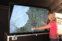
Dr Parcak’s research was funded by a grant from the BBC in the hope of exploring how satellite imagery can be used in conjunction with archaeology. For more than a year, Parcak’s team used a combination of NASA and commercial satellites that orbited 700km above the Earth to capture the images of Egyptian antiquities.
She was able to uncover sites that had been invisible — including a world of houses, tombs and pyramids. Once the images were discovered via satellite, a team of French excavators confirmed what Parcak had seen in the images from space.
’I couldn’t believe that we could locate so many sites all over Egypt,’ she told the BBC. ’To excavate a pyramid is the dream of every archaeologist.’
Dr Parcak worked with Dr Zari Hawass, Egypt’s minister of state for antiquities, who was instrumental in her access to the excavation sites.
At Tanis — the site made famous by the Indiana Jones film Raiders of the Lost Ark — Parcak discovered an ancient network of streets and houses, which are completely invisible from the ground.
https://www.youtube.com/watch?v=WwkThafqL-0


Glasgow trial explores AR cues for autonomous road safety
They've ploughed into a few vulnerable road users in the past. Making that less likely will make it spectacularly easy to stop the traffic for...