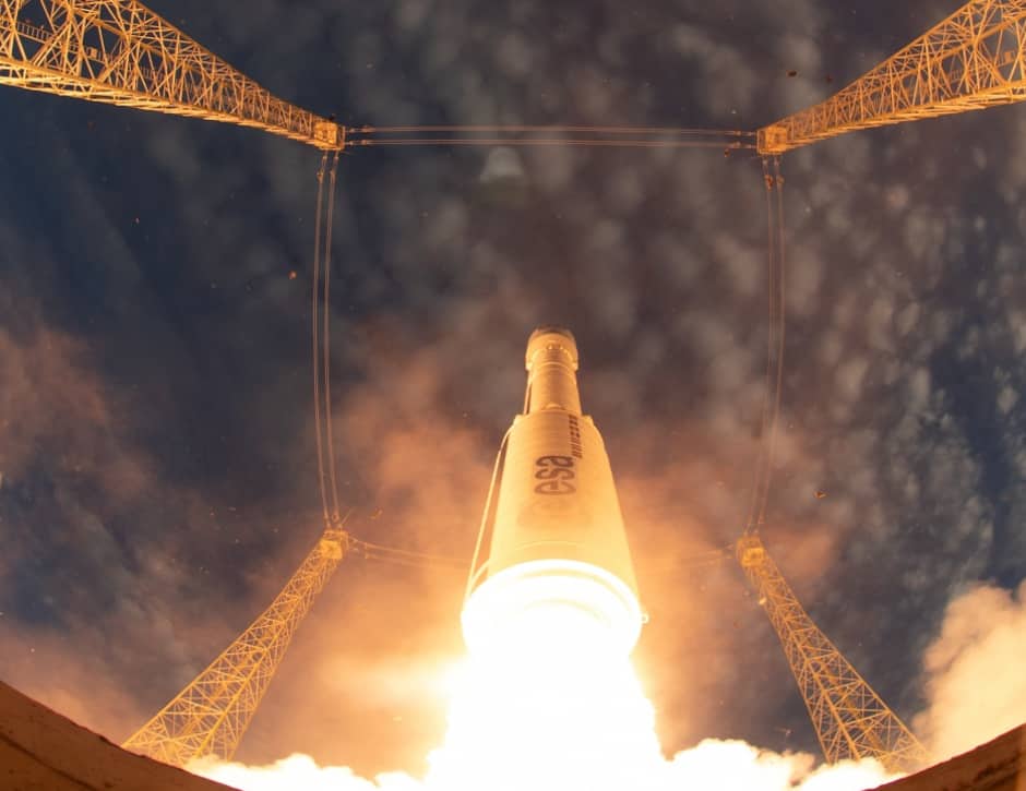
The satellite lifted off atop a Vega launcher from the European Space Agency (ESA) spaceport in Kourou, French Guyana, last night after delays owing to weather conditions. It will now undergo a series of tests after achieving its orbital altitude of 320km (200 miles) before beginning operations.
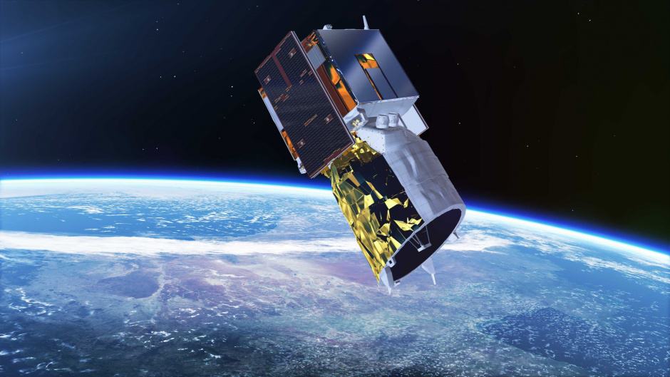
Aeolus was built at Airbus Defence and Space's facility in Stevenage. Weighing 1.4 tonnes, its main instrument is a LIDAR called Aladin, which uses a 3.4kW ultraviolet laser to measure wind speed, the first time such an instrument has been used for such measurements.
Aladin relies on the Doppler effect; the laser signal is reflected back to the satellite by particles of dust and moisture droplets entrained in the airstream, and these reflections are detected by a 1.5m diameter telescope. On-board receivers analyse the Doppler shift in the reflected light from various layers of air, which gives an accurate reading of the windspeed. Other British-made systems on board include cameras, software and propulsion systems. Chelmsford-based e2v supplied a unique Charge Coupled Device (CCD) type detector specifically for the mission.
The fifth of ESA's Earth Explorer missions, Aeolus will provide wind-profile data on a global scale. Of particular value will be data on tropical winds which are very poorly mapped because historically there has been little to no direct observation or measurement. This information will help improve weather forecasting and will also provide data to help climate scientists better understand the complex dynamics of the Earth's atmosphere.
In particular, ESA hopes that it will help climatologists understand how wind, pressure, temperature and humidity are linked by looking at the influence of the wind and exchange of heat and moisture between planet’s surface and the atmosphere. It will also help improve costs of dust and other airborne particles that can affect public health.
“Aeolus epitomises the essence of an Earth Explorer. It will fill a gap in our knowledge of how the planet functions and demonstrate how cutting-edge technology can be used in space,” said Jan Wörner, ESA Director General.
UK science minister Sam Gyimah said: "The Aeolus mission is a great example of the potential real-world impacts that space can have on Earth. Its data will lead to more reliable weather forecasts that can be used by farmers, seafarers, construction workers and others to improve productivity and safety. Space is a key part of our modern Industrial Strategy and it is work like this that shows how vital our role in the European Space Agency is in bringing real benefits to UK companies."
"The UK contribution to Aeolus, by the alliance of UK SMEs and established players led by Airbus, was first class, delivering a revolutionary Earth observation satellite that will give wind profile data in near real time, improving weather forecasting and helping to bring the benefits of space down to every citizen on Earth," said Colin Paynter, managing director of Airbus Defence and Space in Stevenage. "Airbus was honoured to lead Team UK to deliver this spacecraft.”
The Aeolus mission will last for three years, with the satellite orbiting 15 times per day and the orbit cycle (the flight path over specific areas of land) repeating every seven days or 111 orbits. “Aeolus is another first for Airbus, delivering a revolutionary Earth observation satellite that will give wind profile data in near real time, improving weather forecasting and helping to bring the benefits of space down to every citizen on Earth,” said Nicolas Chamussy, Head of Space Systems at Airbus.
ESA’s Director of Earth Observation Programmes, Josef Aschbacher, added, “Aeolus carries the first instrument of its kind and uses a completely new approach to measuring the wind from space. Such pioneering technology has meant that it has been a demanding mission to develop, but thanks to all the teams involved we are thrilled that this extraordinary satellite is now in orbit. We look forward to it living up to expectations.”


Swiss geoengineering start-up targets methane removal
No mention whatsoever about the effect of increased methane levels/iron chloride in the ocean on the pH and chemical properties of the ocean - are we...