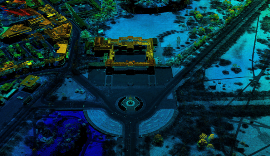
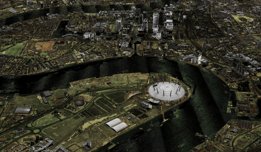
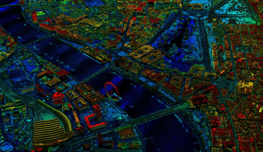
LIDAR (Light Detection and Ranging) surveys use lasers on aircraft to create detailed maps of the landscape, with hundreds of millions of data points bounced back from the Earth to form stunning images. The technique is used by the Environment Agency to help flood modelling and monitor coastal erosion, and 175,000 square kilometres of land has been made available to the public. The ‘point cloud’ data has been collected over the course of the past 18 years, and covers over 75 per cent of England.
In January, start-up Emu Analytics used the open point cloud LIDAR data to develop an interactive map enabling people to see the heights of buildings across London. More recently, the company has expanded that map to include the top 25 urban areas in England.
“It is superb for start-ups like us that the Environment Agency is making its LIDAR point cloud available as open data,” said Jonathan Smith, head of Data Insight at Emu Analytics.
“Point cloud data is a step up in terms of the level of detail we can achieve in modelling infrastructure and the natural environment. We are able to define the shapes of buildings and vegetation and even discover temporary infrastructure, such as cranes.”
“With the detail that point cloud provides we will be able to open up new use cases and offerings such as providing clutter data for line-of-site broadband companies or calculating the shadows nearby buildings would cast on a proposed array of solar panels.”
Using the point cloud data users are also able to create customised elevation models with additional information about the type of ground feature being surveyed, or the time the survey was conducted. These features should enable more accurate infrastructure and city planning.


Red Bull makes hydrogen fuel cell play with AVL
Formula 1 is an anachronistic anomaly where its only cutting edge is in engine development. The rules prohibit any real innovation and there would be...