
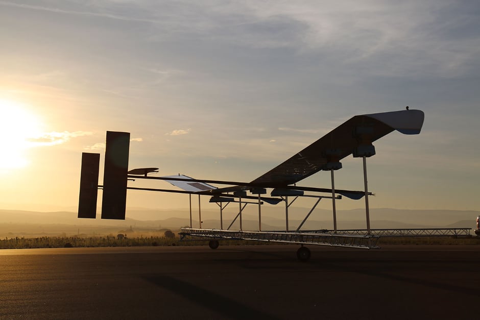
With a wingspan of 38m and weighing 149kg (including a payload of up to 25kg), the aircraft will be positioned to view any part of the Earth and collect data for 90 days at a time over wider areas compared to conventional aerial imagery capture. The aircraft will operate between 20–22km and fly a pre-determined route or remain above a specified position.
“The UK has a particularly successful track record in mapping and associated technology,” said business minister Lord Henley. “As well as having the potential to support key government objectives such as upgrading the UK’s infrastructure, it could benefit emerging technological areas such as smart cities and self-driving vehicles which both rely on accurate 3D mapping.”
Astigan Ltd was established in 2014 by Ordnance Survey and private investors to develop and commercialise Britain’s first commercial sub-orbital Earth Observation HAPS.
Ordnance Survey said that when it comes into production Astigan will have the potential to work alongside existing mapping capabilities to improve the speed, accuracy and cost involved in aerial mapping.
Brian Jones, Astigan managing director, said: “This remarkable aircraft has met every goal and passed all milestones in its ambitious development programme so far. We are excited about the year ahead as we increase our flights and move towards a fully operational high-altitude test. By the end of 2019 we aim to be completing endurance flight testing, building up to 90 days non-stop, which is the operational capability we’re striving for.
“It’s incredibly exciting that the UK has developed this kind of technology, delivering satellite capabilities, unparalleled flexibility and improved efficiency, all at a vastly reduced cost. We look forward to completing this project and seeing the aircraft deliver on its outstanding potential, which should provide a range of scientific and environmental benefits.”
As well as geospatial data and mapping, Astigan could also provide climate and environmental monitoring services; early warning, observation and communications over natural disasters; and support for global land management and urbanisation challenges.
Neil Ackroyd, a co-founding director of Astigan and acting CEO of Ordnance Survey, said: “[Astigan] has produced a unique, British-made platform which can carry a range of interchangeable earth observation instruments such as high-precision cameras, atmospheric monitoring systems and multi-spectral sensors.
“Astigan supports Ordnance Survey in enhancing its capabilities to work in partnership with other nations across the globe. By aligning this capability with our…geospatial production and mapping expertise, we hope to support organisations and countries in tackling major societal challenges.”
JLR teams with Allye Energy on portable battery storage
This illustrates the lengths required to operate electric vehicles in some circumstances. It is just as well few electric Range Rovers will go off...