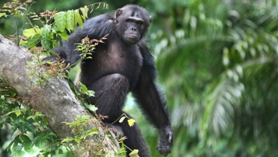
Researchers at Leicester University have signed a memorandum of understanding with the Jane Goodall Institute (JGI) to explore how remote sensing data, combined with machine learning approaches, can help to map, characterise and develop further understanding about the habitats of chimpanzees in the Tchimpounga Nature Reserve.
Scientists count elephants from space using AI
STEM challenge looks to drones for wildlife protection
The collaboration seeks to advance a number of projects that will provide scientific insights about the forest and woodlands of Tchimpounga, in the Congo Basin, which is the home of the Tchimpounga Chimpanzee Rehabilitation Centre.
Chimpanzees are listed on the International Union for Conservation of Nature (IUCN) Red List as an endangered species. For more than 40 years the Jane Goodall Institute has worked to advance scientific and public understanding of chimpanzees, as well as their conservation, through community-driven approaches.
Professor Kevin Tansey, of the School of Geography, Geology and the Environment, will work with colleagues at Space Park Leicester to support the research and knowledge exchange programme. He said: “The timing allows us to develop the project scope within the context of moving into Space Park Leicester where we can talk with our industry partners who are experts at data collection from drones and aircraft.”
Lilian Pintea, vice-president of Conservation Science at the Jane Goodall Institute USA said: “JGI’s vision for the application of science and technology is to explore, innovate, and discover new solutions, technologies, and tools to accelerate the pace and scale of our conservation impact.
“We have been creating research-implementation spaces where scientists, companies, students, communities, policymakers and others could have a dialogue, collaborate, and convert innovative technologies and data into better conservation decisions.”
The projects will focus on the use of LiDAR (Light Detection and Ranging). In a statement Professor Tansey said: “A laser scanner collects millions of points or hits from objects, natural or constructed, in our environment. Whether placed on a drone or an aircraft for the top down view, or mounted on a tripod or strapped to your back for the ground view, the eye-safe laser scanner points are stored forever. They are then rendered in 3D and classified.
“We will develop clever algorithms to look for structural features that are associated with their nests and, who knows, we may be able to spot the chimpanzees themselves. Integration of these data sets with high resolution optical data with short return interval, such as those from Maxar or PLANET can help us develop forest monitoring systems in the future.”
Funding from Leicester University’s QR Global Challenges Research Fund (Research England) will support project planning, the collection and analysis of data from a pilot UK site and the delivery of online courses and workshops on laser scanning with JGI and their local partners.


April 1886: the Brunkebergs tunnel
First ever example of a ground source heat pump?