
With 79 confirmed fatalities and dozens of people still missing, the horrific wildfires currently raging across Greece are the deadliest in the country’s recent history.
Crews battling the blaze are facing terrible conditions, with gale-force winds causing the fires to spread so quickly that many of those caught in their path have simply had no time to escape.
Dramatic satellite images – such as the one below gathered by NASAs Earth Science Data and Information System (ESDIS) - show just what the firefighters are up against.
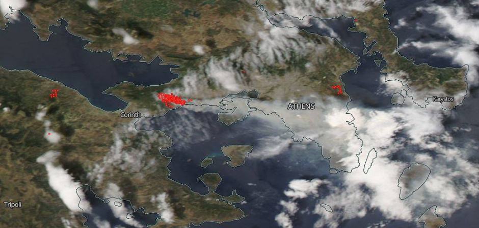
Captured on July 24, 2018, the image shows actively burning areas (hot spots) outlined in red. Each hot spot is an area where the thermal detectors on the satellite recognised temperatures higher than background. The plumes of smoke which accompany these hot-spots indicate the location of a fire.
With the whole of Europe in the grip of a heatwave, it’s not just Greece that’s been affected. Last month, homes were evacuated and the army called in as a huge blaze took hold on Saddleworth moor in the UK.
Fires have even broken out in the Arctic Circle, with around 50 fires now thought to be burning across Northern Sweden.
An image captured by the Copernicus Sentinel-2 mission on 17 July 2018 shows a detailed view of flames and smoke from two of the fires, along with smoke from other fires in the vicinity.
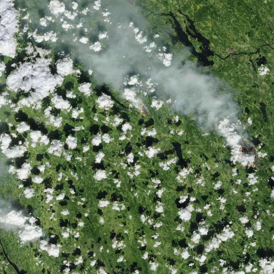
Sentinel-2 carries an innovative wide swath high-resolution multispectral imager with 13 spectral bands. The mission includes two identical satellites in the same orbit, 180° apart for optimal coverage and data delivery.
Whilst its currently unclear whether these images are being used to help coordinate the response to Europe’s wildfires, it’s certainly the case that satellite imaging is becoming an increasingly important tool for wild-fire fighters.
Sean Triplett of the US Forest Service recently told The Engineer that whilst satellites have been used for a number of years to understand the impact of wildfires, the emergence of cubesats – smaller, lower-cost devices that are becoming increasingly widely used by the research community – holds great promise for wildfire monitoring. These diminutive spacecraft could, he said, be launched into orbit in flocks of up to 200, providing far more persistent coverage than existing orbiting satellites, which typically passed by only every four to six hours.
Glasgow trial explores AR cues for autonomous road safety
They've ploughed into a few vulnerable road users in the past. Making that less likely will make it spectacularly easy to stop the traffic for...