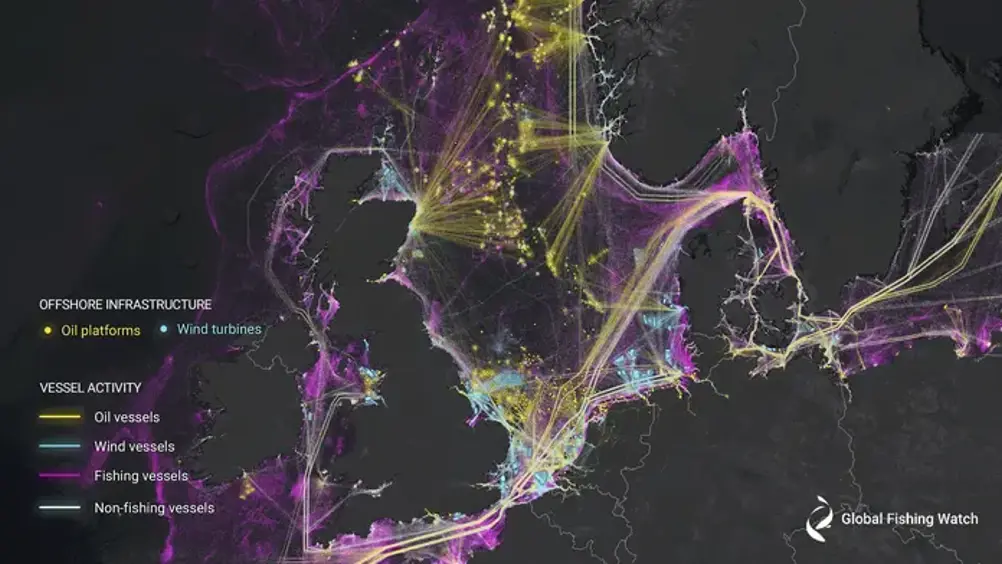
AI and satellite imagery reveals expanding footprint of human marine activity
New research has used machine learning and satellite imagery to create the first global map of large vessel traffic and offshore infrastructure.

Led by Global Fishing Watch, the study published in Nature is said to offer an unprecedented view of previously unmapped industrial use of the ocean and how it is changing.
The analysis revealed that around 75 per cent of the world’s industrial fishing vessels are not publicly tracked, mostly around Africa and south Asia. Similarly, over 25 per cent of transport and energy vessel activity is missing from public tracking systems.
Researchers from Global Fishing Watch, the University of Wisconsin-Madison, Duke University, UC Santa Barbara and SkyTruth analysed two million gigabytes of satellite imagery from 2017 – 2021 to detect vessels and offshore infrastructure in coastal waters across six continents.
By synthesising GPS data with five years of radar and optical imagery, the researchers were able to identify ‘dark’ vessels. Using machine learning, they then concluded which of those vessels were likely engaged in fishing activity, to create the ‘most comprehensive’ public picture of global industrial fishing available.
Register now to continue reading
Thanks for visiting The Engineer. You’ve now reached your monthly limit of news stories. Register for free to unlock unlimited access to all of our news coverage, as well as premium content including opinion, in-depth features and special reports.
Benefits of registering
-
In-depth insights and coverage of key emerging trends
-
Unrestricted access to special reports throughout the year
-
Daily technology news delivered straight to your inbox


National Gas receives funding to develop Gravitricity underground hydrogen storage system
One single rock salt mine - Winsford - has 23 <i>MILLION </i>cubic metres of void and even allowing for 10% of that void set aside for hazardous waste...