
After completing a PhD in radar research for geoscience applications co-funded by Leonardo and Edinburgh University, Fiona’s initial work in this area impressed the Royal Commission for the Exhibition of 1851 so much, that they awarded her a fellowship to help her with her research.
The Royal Commission was set up by Prince Albert after the 1851 Exhibition to boost British industry. It has been going ever since providing Industrial Fellowships to recent graduates for them to develop innovative technology with commercial potential while completing a PhD or EngD.
Engineering careers have many routes but one destination
The Royal Commission funded flight trials that allowed Fiona to fit Leonardo’s PicoSAR radar to helicopters to gather data. This technology can chart changes in the environment with great accuracy, which could offer vital information to environmentalists and potentially save lives by avoiding hazards such as flooding and landslides.
Fiona explained: “By continuously monitoring the same area with this radar, it allows you to detect the signs which can indicate an environmental incident may be about to occur. For example, evidence of small changes in the height of land could reveal that there may be a risk of a landslide.
"Equally, relatively minor increases in water levels could be early indicators of flooding. We want to give environmental agencies the ability to plan ahead and take action early to safeguard not only the environment, but people’s wellbeing.”
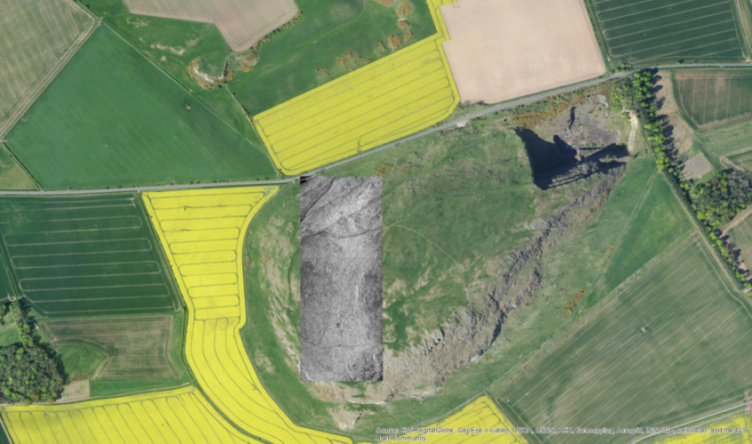
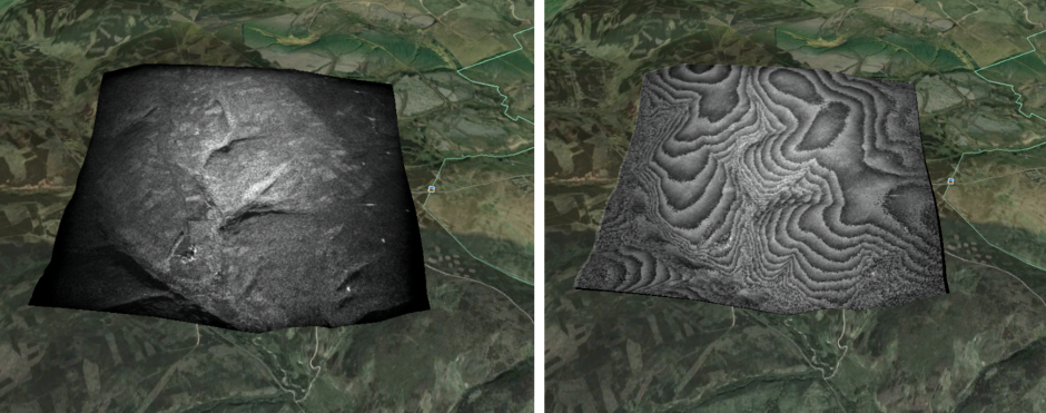
Fiona’s application to the commission included an interview that allowed her to demonstrate the robustness of her proposal for Synthetic Aperture Radar Interferometry (InSAR), a technique used to produce highly accurate images of the environment.
SAR images of the Earth’s surface are already used extensively in the field of Geoscience for applications such as mapping, forecasting and the prevention of risks caused by natural phenomena, such as landslides and earthquakes.
Satellites provide global coverage and the data they gather is relatively cheap. However, satellite images do not capture the ground height of vegetation at fine resolution. Fiona aims to overcome this issue by allowing heights of objects under the canopy to be measured more often than was possible before, by using airborne imagery.
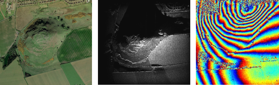
Established geoscientists initially met Fiona’s findings with surprise, as they had assumed that the airborne aircraft would be too unstable to record information in comparison to a stable satellite, but the data proved to be accurate.
Now three years into her career as a Systems Engineer at Leonardo, Fiona’s next goal is to ensure the radar technology is affordable for environmental agencies, so she is collaborating with Leonardo colleague Euan Ward, who is also a Royal Commission Fellow, to tap into his findings on the applications of signal processing.
Euan believes that signal processing can allow modern radars to operate in environments crowded with radio frequency energy, by improving reliability in applications like driverless cars or the detection of misused drones.


Glasgow trial explores AR cues for autonomous road safety
They've ploughed into a few vulnerable road users in the past. Making that less likely will make it spectacularly easy to stop the traffic for...