Leading the study, Nottingham’s Rights Lab combined different data sources and methods to build a set of criteria measuring the extent of labour exploitation in a settlement. They then validated the criteria with a government agency and a non-governmental organisation (NGO) involved in fighting labour exploitation. The ESRC-funded study has been published in the journal of Production and Operations Management.
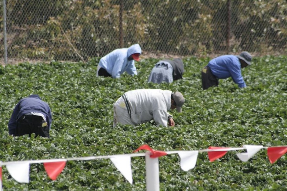
Described by Nottingham as a ‘world-first in the humanitarian sector’, the method has been used to successfully address labour exploitation in areas where strawberries are harvested through a combination of earth observation data with operations management techniques.
In May 2013, three local field guards shot and injured 30 Bangladeshi migrant workers in the strawberry fields of Nea Manolada. In March 2017, the European Court of Human Rights (ECtHR) ruled that the workers had been subjected to forced labour and that Greece had violated Article 4 of the European Convention on Human Rights by not preventing human trafficking of irregular migrant workers.
Remote-sensing technique hastens subsurface surveys
“The use of seasonal workers, the relatively low level of skills required, a strong level of outsourcing and agent-based recruitment of workers increase the likelihood of labour exploitation,” said Dr Ioannis Kougkoulous, who led the study at the Rights Lab.
“Forced migration caused by crises around the world exacerbates this phenomenon. Refugees and migrants often live-in illegality and experience serious financial distress, which puts them at high risk of becoming victims of labour exploitation. Governments are responsible for ensuring equal treatment for migrant and national workers on their territory, and to protect migrants from being employed under substandard conditions.”
The consortium used remote sensing satellite technology for real-time data collection to identify migrant settlements, which were then investigated and verified (known as ‘ground-truthing’). Inspection teams on the ground collected data from each settlement using questionnaires to address standards required for Multi-Criteria Decision Analysis (MCDA), a method used to formalise and address competing decision objectives.
Each settlement was ranked using the MCDA model, with government and humanitarian organisations then able to intervene in top-priority settlements first, allocating resources to the most vulnerable migrant workers to improve living conditions.
Dr Doreen Boyd, co-author, Rights Lab associate director and professor of earth observation at Nottingham University led the ESRC grant. She explained that the approach could be replicated in other agricultural activities where cheap labour is abundant, such as in Italian tomato fields or tobacco-producing regions in Argentina.
“We have demonstrated how remote sensing data enables the identification and location of informal settlements of workers in potential situations of labour exploitation over a large geographic area (140km2),” she said. “Identifying these settlements from the ground would require driving around the entire study area in search of possible settlements, which would be costly and ineffective since many settlements are not visible from the road."


Glasgow trial explores AR cues for autonomous road safety
They've ploughed into a few vulnerable road users in the past. Making that less likely will make it spectacularly easy to stop the traffic for...