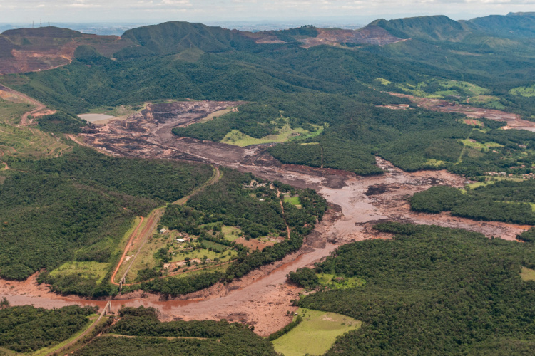
Satellite radar technique developed to predict dam collapse
A new study by Nottingham and Durham Universities claims that the 2019 Brazilian dam collapse could have been foreseen with the right monitoring technology.

The collapse in south-east Brazil, which took place on 25 January 2019 at a tailings dam near the Corrégo do Feijão iron ore mine in Minas Gerais state, was one of Brazil’s worst environmental disasters, killing over 200 people.
Owned by Vale, Brazil’s largest mining company, the dam was used for more than 40 years to hold waste from the mine. Its collapse caused a torrent of sludge to cover surrounding land, destroying homes and polluting rivers with toxic material.
The study’s lead author, Dr. Stephen Grebby from the Nottingham Geospatial Institute at the University, said that a significant number of these types of dam need enhanced monitoring.
“Most mining companies currently rely upon ground-based sensors to monitor the stability of dams,” Grebby explained. “However, these typically offer an inadequate coverage of measurements across the whole of the dam, which can make it difficult to detect movement or other signs of distress.”
Register now to continue reading
Thanks for visiting The Engineer. You’ve now reached your monthly limit of news stories. Register for free to unlock unlimited access to all of our news coverage, as well as premium content including opinion, in-depth features and special reports.
Benefits of registering
-
In-depth insights and coverage of key emerging trends
-
Unrestricted access to special reports throughout the year
-
Daily technology news delivered straight to your inbox


National Gas receives funding to develop Gravitricity underground hydrogen storage system
One single rock salt mine - Winsford - has 23 <i>MILLION </i>cubic metres of void and even allowing for 10% of that void set aside for hazardous waste...