UK radiation-mapping drone heads for Fukushima
A UK-developed quadcopter drone with radiation-mapping capabilities is set to be deployed on the damaged reactor building of the Fukushima nuclear power plant in Japan.
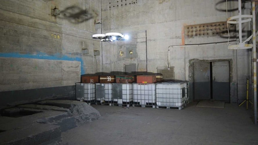
RISER uses lasers to operate autonomously deep inside hazardous facilities (Credit: NDA)
RISER (Remote Intelligence Survey Equipment for Radiation), combines software from Cockermouth-based Createc with a UAV developed by Blue Bear, from Bedford. Createc’s N-Visage radiation mapping software creates a high-definition 3D picture of contamination, while the UAV uses lasers to operate autonomously deep inside hazardous facilities where GPS signals can’t reach. The collaboration has received financial backing from the Nuclear Decommissioning Authority (NDA) as well as Innovate UK.
“We are thrilled to see RISER put to work in Japan, and delighted that our early-stage support for the N-Visage system enabled Createc to develop its potential further,” said Prof Melanie Brownridge, the NDA’s head of technology.
“The subsequent collaboration with Blue Bear, again funded by the NDA through an initiative with Innovate UK, led to RISER. This shows the importance of funding innovative ideas through their journey from the drawing board to the market – not just for the NDA’s decommissioning mission but for the wider UK and overseas economy.”
Register now to continue reading
Thanks for visiting The Engineer. You’ve now reached your monthly limit of news stories. Register for free to unlock unlimited access to all of our news coverage, as well as premium content including opinion, in-depth features and special reports.
Benefits of registering
-
In-depth insights and coverage of key emerging trends
-
Unrestricted access to special reports throughout the year
-
Daily technology news delivered straight to your inbox


National Gas receives funding to develop Gravitricity underground hydrogen storage system
One single rock salt mine - Winsford - has 23 <i>MILLION </i>cubic metres of void and even allowing for 10% of that void set aside for hazardous waste...